
The Role of Civil Engineering in Modern Development
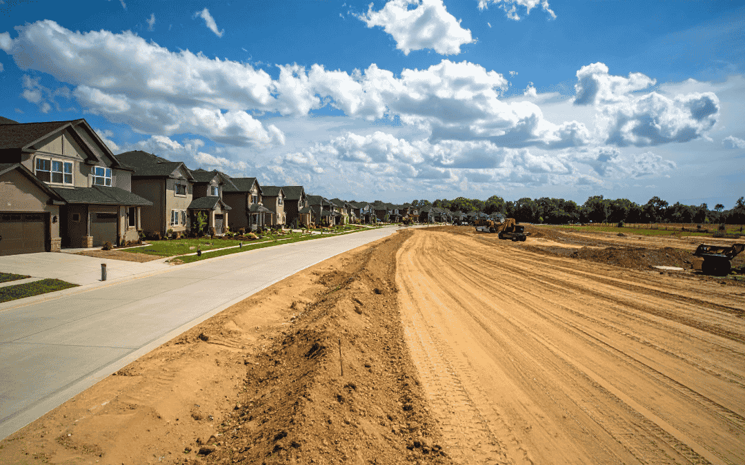
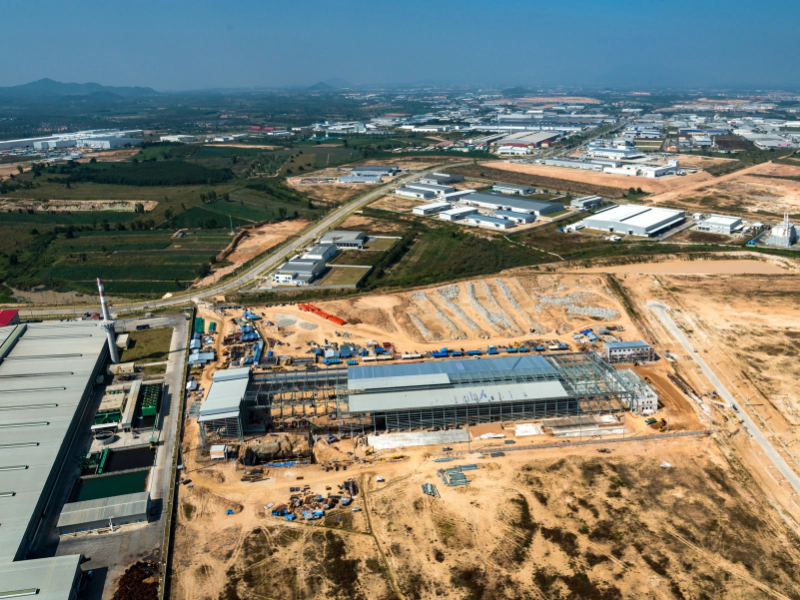
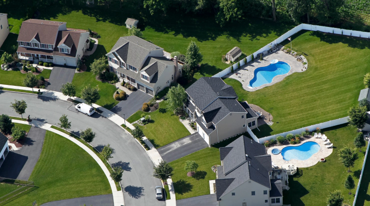
Civil engineering serves as the backbone of functional and sustainable communities. This discipline transforms raw land into thriving residential neighborhoods, productive commercial centers, and efficient industrial facilities through careful analysis, strategic planning, and technical precision.
The profession demands a unique combination of scientific knowledge, practical experience, and forward-thinking vision. Licensed civil engineers apply principles of hydraulics, geotechnics, structural mechanics, and environmental science to create infrastructure that serves current needs while anticipating future growth. Every project begins with understanding site-specific conditions including soil composition, existing topography, hydrological patterns, and surrounding development constraints.
Successful land development requires coordination among multiple stakeholders including property owners, municipal authorities, utility providers, and construction teams. Civil engineers act as technical advisors who translate project visions into buildable plans that satisfy regulatory requirements and construction realities. This role extends beyond drawing plans to include construction observation, quality assurance, and problem-solving when field conditions differ from initial assessments.
In the Dallas-Fort Worth metropolitan area, rapid population growth creates constant demand for residential subdivisions, retail centers, office parks, and industrial warehouses. Each project type presents distinct engineering challenges. Residential developments must balance affordability with quality infrastructure that will serve families for decades. Commercial sites require robust utility systems and efficient traffic circulation to support business operations. Industrial facilities need specialized grading and drainage solutions to accommodate heavy equipment and loading operations.
The increasing frequency of intense rainfall events throughout North Texas has elevated the importance of comprehensive stormwater management. Engineers must design systems that protect properties from flooding while meeting strict environmental regulations governing water quality and discharge rates. This responsibility extends beyond individual project boundaries to consider cumulative impacts on downstream properties and regional drainage networks.
Site Analysis and Development Planning
Every successful development project begins with thorough site investigation and feasibility assessment. This initial phase establishes the technical foundation that guides all subsequent design decisions and construction activities. Engineers collect data through boundary surveys, topographic mapping, geotechnical investigations, and utility research to build a complete picture of existing conditions.
Topographic surveys capture existing ground elevations across the property, revealing natural drainage patterns, slope conditions, and elevation changes that influence grading strategies. This information proves critical for determining optimal building pad locations, roadway alignments, and stormwater flow paths. Properties with significant elevation changes may offer opportunities for walkout basements or terraced development but often require more extensive earthwork and retaining structures.
Soil conditions directly impact foundation design, pavement sections, and construction methods. Geotechnical engineers perform soil borings and laboratory testing to classify soil types and determine bearing capacity, expansion potential, and permeability characteristics. Expansive clay soils common throughout the region require special attention during foundation design to prevent structural damage from seasonal moisture variations. Understanding soil behavior early in the planning process prevents costly remediation efforts during construction.
Utility availability shapes development feasibility and project costs. Engineers research existing water mains, sanitary sewer lines, storm drainage systems, electric service, and natural gas infrastructure to determine connection points and required extensions. Properties lacking nearby utilities may require significant investment in off-site improvements or alternative systems like private wells and septic systems depending on local regulations and site conditions.
Zoning regulations, floodplain restrictions, and environmental constraints establish the framework within which development must occur. Municipal zoning ordinances specify permitted land uses, density limits, setback requirements, and parking standards that define the development envelope. Properties within mapped floodplains face additional requirements to protect structures and minimize flood risks. Wetlands, protected habitats, and historical features may require special permits or impose development restrictions that affect site layouts and construction methods.
Concept planning transforms site data and regulatory requirements into preliminary layouts that demonstrate project feasibility. Engineers work with developers and architects to position buildings, roads, parking areas, and open spaces in configurations that maximize property value while satisfying technical and regulatory constraints. Multiple concept alternatives allow comparison of different approaches regarding construction costs, marketing appeal, and long-term functionality.
Grading and Earthwork Optimization
Grading design establishes final ground elevations that support proper drainage, accommodate structures and pavements, and create functional outdoor spaces. This engineering task requires balancing multiple objectives including stormwater management, construction economy, aesthetic appeal, and accessibility requirements. Skilled grading design minimizes earthwork quantities while achieving project goals through strategic placement of cuts and fills.
Earthwork optimization analyzes soil movement to balance excavation volumes with fill requirements across the site. Moving soil short distances costs less than importing material from off-site sources or hauling excess material to disposal locations. Advanced software tools calculate cut and fill volumes from existing and proposed grade surfaces, identifying opportunities to redistribute material efficiently. Projects that achieve balanced earthwork can save substantial costs on large developments where even small grade adjustments affect thousands of cubic yards.
Drainage patterns dictate grading configurations to direct runoff away from buildings toward collection systems. All surfaces must slope sufficiently to prevent ponding while avoiding excessively steep grades that cause erosion or create safety hazards. Minimum slope requirements typically specify two percent grades for paved areas and three percent for landscaped areas to ensure positive drainage during typical rainfall events. Swales, berms, and graded channels convey water to inlets and detention facilities sized to handle design storm intensities.
Building pad elevations require careful consideration of foundation types, finished floor requirements, and relationship to adjacent features. Structures should sit high enough to provide positive drainage around foundations and prevent water intrusion but not so high that excessive fill creates settlement risks or requires retaining walls. The transition from building pads to parking areas, sidewalks, and landscaping must accommodate required slopes while maintaining accessibility standards, particularly for commercial and public facilities subject to barrier-free design requirements.
Retaining walls become necessary when grade changes exceed stable soil slopes or when limited property area demands vertical transitions between elevation differences. These structures range from simple residential garden walls to substantial engineered systems supporting roadways or building pads. Wall selection depends on height requirements, soil conditions, aesthetic preferences, and cost considerations. Proper design addresses structural stability, drainage behind walls, and integration with surrounding grades.
Construction phasing strategies sequence earthwork activities to maintain site accessibility and control erosion throughout the building process. Initial clearing and stripping removes vegetation and topsoil for stockpiling and later reuse in landscaping. Rough grading establishes general site contours and installs underground utilities before fine grading prepares surfaces for pavement and structures. Proper sequencing prevents equipment from damaging completed work and allows drainage facilities to function during construction to manage runoff from disturbed areas.
Stormwater Management and Drainage Systems
Stormwater management represents one of the most critical aspects of site development, protecting properties from flood damage while addressing water quality concerns and regulatory requirements. Development converts pervious vegetated areas into impervious roofs, parking lots, and roadways that increase runoff volumes and peak flow rates. Engineering design must mitigate these impacts through strategic collection, conveyance, and detention systems.
Hydrologic analysis calculates runoff quantities based on rainfall intensity, watershed characteristics, and surface conditions. Engineers apply established methods like the Rational Method for small watersheds or more sophisticated hydrograph techniques for complex sites to determine design flows for various storm frequencies. Municipal regulations typically require designs to accommodate storms with specific return periods, commonly ranging from 10-year events for minor systems to 100-year events for major drainage pathways.
Detention facilities temporarily store runoff during storm events and release water at controlled rates that prevent downstream flooding. These systems take various forms including wet ponds with permanent water pools, dry basins that drain completely between storms, and underground storage chambers in space-constrained urban sites. Sizing calculations account for inflow volumes, outlet structure capacity, and required storage volume to reduce peak discharge to pre-development levels or allowable release rates specified by drainage authorities.
Outlet structures control release rates from detention facilities through carefully designed orifices, weirs, and sometimes mechanical systems. Multiple-stage outlets provide different discharge rates for various water levels, allowing smaller storms to drain relatively quickly while larger events utilize full storage capacity. Trash racks and debris protection prevent clogging that could cause uncontrolled overflows. Emergency spillways provide overflow paths for extreme events exceeding design capacity, protecting dam integrity and directing excess water away from structures.
Storm sewer systems collect and convey runoff through networks of inlets, pipes, and junction structures. Design begins at the most downstream point and works upstream, calculating flow accumulation and sizing pipes to maintain adequate capacity and velocity. Inlet spacing depends on pavement slopes, gutter capacity, and allowable spread onto traffic lanes. Pipe materials including reinforced concrete, corrugated metal, and high-density polyethylene each offer advantages regarding strength, cost, and installation methods suited to specific applications.
Water quality treatment has become increasingly important as regulations address pollutant loading to streams, lakes, and aquifers. Best management practices filter sediments, absorb nutrients, and break down hydrocarbons before stormwater enters natural waterways. Options include vegetated swales, bioretention cells, permeable pavement, and proprietary treatment devices. Selection depends on available space, soil conditions, maintenance capabilities, and specific pollutants of concern for each watershed.
Downstream analysis evaluates impacts on existing drainage systems and adjacent properties. Engineers trace flow paths beyond project boundaries to identify potential bottlenecks, undersized culverts, or areas prone to flooding that could be affected by additional runoff. Some jurisdictions require formal downstream assessments documenting conditions for a specified distance or to the nearest adequate outfall. Mitigation may involve detention, off-site improvements, or financial contributions to regional drainage projects.